
This year has been a poor one for me walking wise. I’m still being troubled by knee pain and it’s hard to forecast when it is going to strike. I’ve found it has really dented my confidence; my walks when I do manage are short and local and often just spur of the moment. If I feel fit enough I’ll go out for a short ramble, and I can’t plan anything in advance, and haven’t walked with the Glasgow HF for over a year now. This week has seen me with a few days off and no prior commitments, and a knee that felt reasonably reliable. Time for a walk. The question was: where?
Earlier in the year I had spotted an article in TGO magazine about 724m high Ingleborough, the highest peak in Yorkshire. It looked a reasonable option and possibly something within my capabilities. When I had originally considered going in the summer I had planned to go down and camp overnight, mainly because of the length of the rail journey, but now in October with long nights and grim weather forecast I wondered if I could do it as a day walk, as spending a long, wet night in a tent for no good reason just wasn’t appealing. Checking the timetable, I saw that if I got the first train from Drumgelloch I could be in Yorkshire for around 1030.
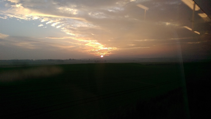
Sunrise: deceptively promising
So it was that I was up at oh-my-God-it’s-still-dark-o’clock to catch the first of the three trains which would take me to my final destination: Horton-in-Ribblesdale. The weather was promising as the train passed Carstairs, a thin mist hung over the moors, illuminated by an amber sunrise. As I went south though, the weather steadily worsened, drip by drip, and by the time I stepped onto the platform at Horton the rain was blowing horizontally across the dales.
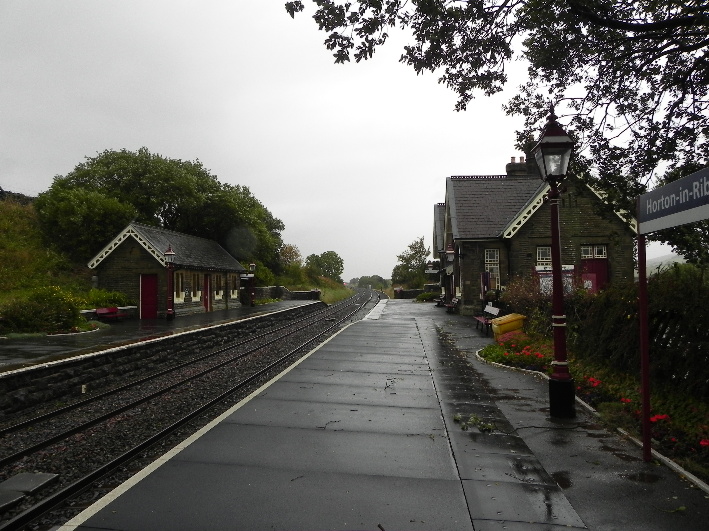
Horton-In-Ribblesdale
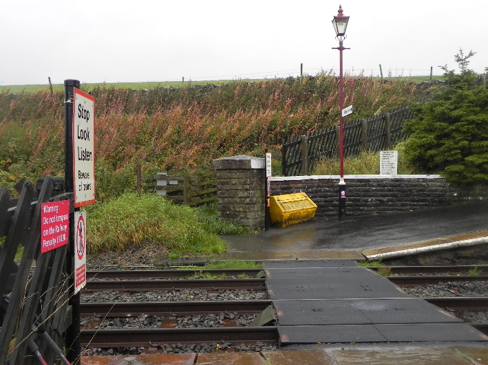
The start of the Right of Way
As with many remote stations you have to cross the line on a foot crossing while ignoring the signs that warn you to stay off the line. The footpath begins at the end of the platform and leads up into pastured fields where sheep huddle forlornly against the wind. Off to the south west I can hear the clanking of machinery from a vast quarry and I can spy a pond with Caribbean blue water, an odd sight I can only attribute to the quarry workings. As I consider my route on the map a figure runs past, a short clad fell runner. I can only look on jealously as he disappears into the murk.
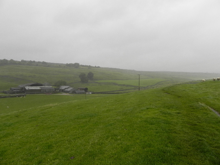
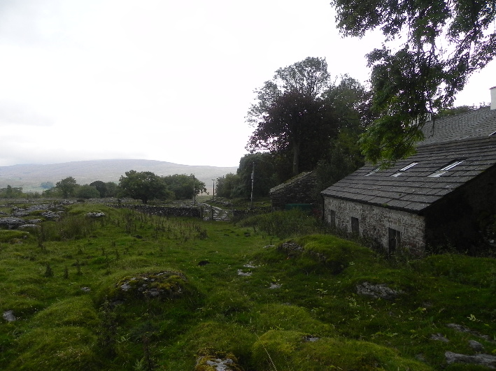
Beecroft Hall
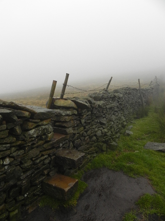
I follow the right of way, denoted as a red dotted line on the map. I’m soon at a gate next to an interpretation board explaining the geological history of the area, famous for its limestone pavements. Over thousands of years these have weathered, frozen and split, forming clints and grykes. There are also holes which drop away into the hill, and it is recommended that you stay on the paths to avoid falling into them. The other feature which catches my eye is not a natural one, although it is made of natural material. Dry stane walls stretch off in all directions, hemming you in and limiting your choice of route. By sticking to the paths you can be assured of finding a well maintained crossing point, be it a gate, stile or a series of stone steps built into the walls. Detours are dangerous and impractical here.
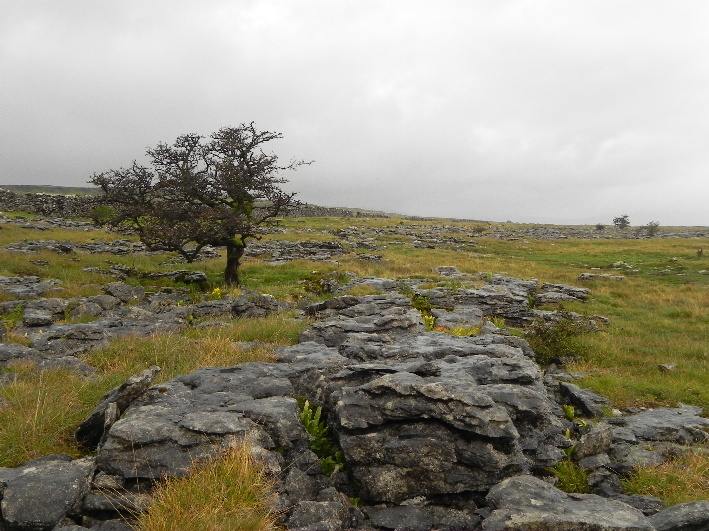
Limestone Pavements
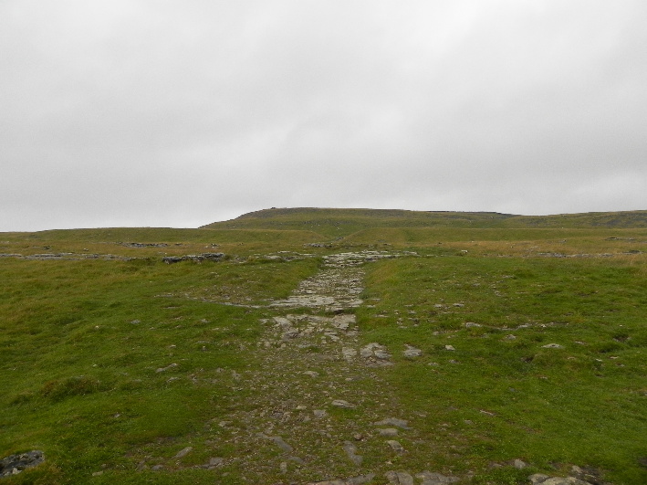
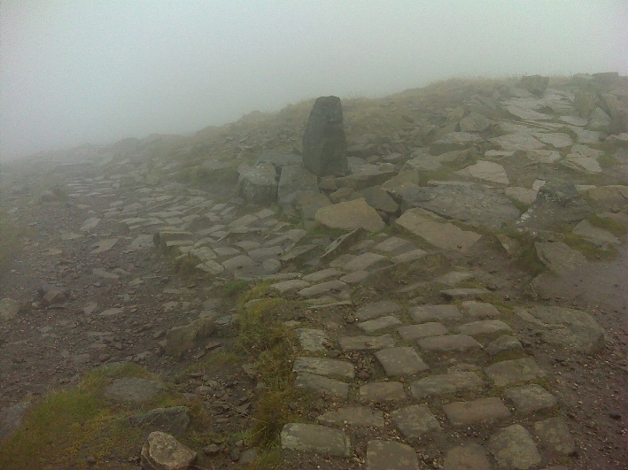
I follow the path through the first in a series of limestone outcrops and breach the top where a long straight stretch of path appears ahead of me, leading on to another series of outcrops and the Sulber Crossroads, where the right of way meets the Pennine Bridleway. At just over a kilometre distant it is not far, but the first bit of doubt creeps into my mind about whether I can manage. I have been off the hills too long and am questioning my capabilities. So much so that when I reach the crossroads I decide not to take the bridleway towards Clapham Bottoms and the renowned Gaping Gill, and instead take the direct route to Ingleborough. Its a decision which will pay off later in the day.
The bleak, bleak moor
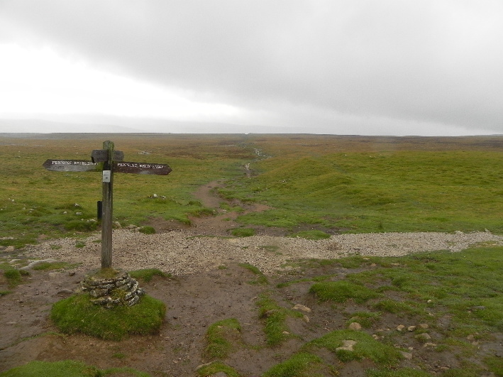
Sulber Crossroads
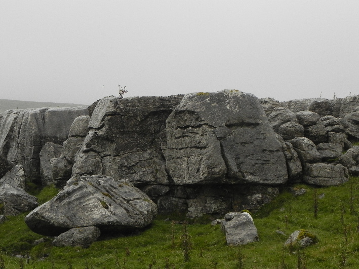
Limestone
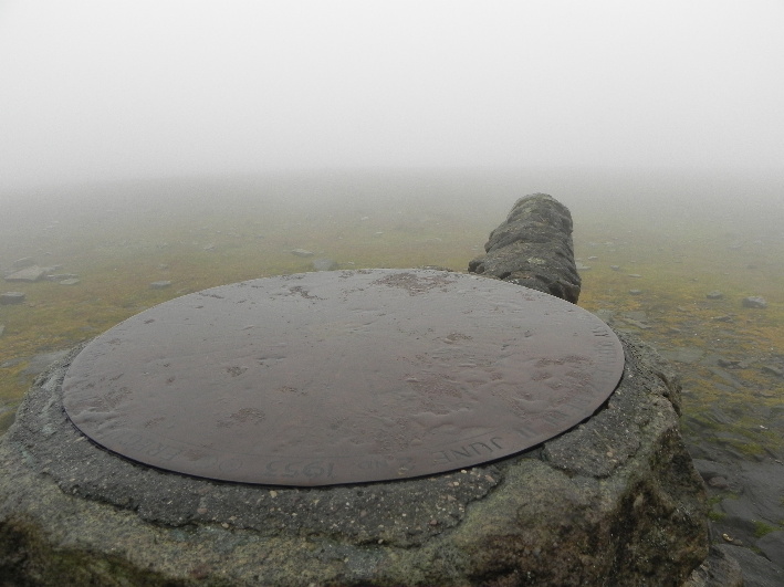
The path rises through the oddly shaped limestone which is almost shoulder high at times. Many feet have passed this way and the stone is worn smooth and slick with rain. It’s tricky going and care is required. Soon I have cleared the limestone and looking back it stands out vividly, like the ground has been dusted with snow. The rain is not conducive to taking photograph, so I turn and head on, and after the ruins of Nick Pot (with it’s open collection pot to raise money for path maintenance) the path rises steeply, and I find myself sweating inside my waterproofs. Soon the angle of ascent eases and I count paces through the clag, for something to do if truth be told. There’s no view, no animal life, no company and no chance of losing the path, cut clearly along the flank of Simon Fell. It’s only as you approach the summit plateau that the hill becomes steep and craggy. Once the plateau is reached it’s not long until what appears in the mist to be a hut looms up. Closer inspection reveals it to be not a hut, but a cross shaped wind break with a brass plate on top, identifying far off hills which on a day like this simply rubs salt in. I could be anywhere for all I can see. I clamber about in the mist searching for a few geocaches hidden amongst the rocks, finding one and failing to locate the other, before taking my leave of the summit, following in the trail of the fell runner who I encountered on the way up now heading down. It’s not a day for lounging. 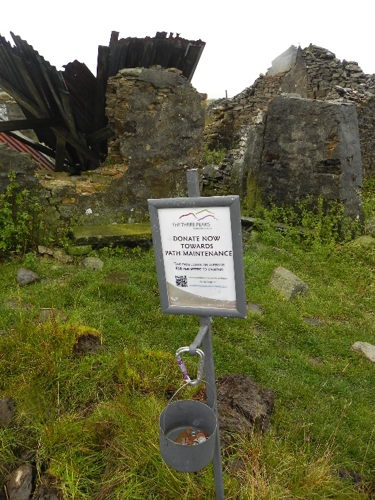
Stick to the paths and you can always find a crossing point
The summit shelter
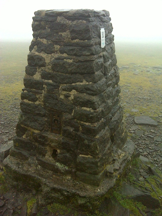
The trig point is about 30m from the shelter
From here I drop down the way I came by a few hundred metres to a small stone sentinel, who guards the junction of two paths. I’m now taking what appears to be a paved path which will take me along the signposted “ridge walk”, which in reality skirts along just below the top of Top of South House Moor before a finally ascending to Park Fell. The path here was slippy and I found myself on more than one occasion with arms and legs flying in all directions as I lost balance. I took a short break for something to eat, biscuits and jam giving me a burst of energy. It also allowed a respite for my knee, as I had been on the move for a few hours with no real break.
The “Sentinel” and the distinctive cobbled path
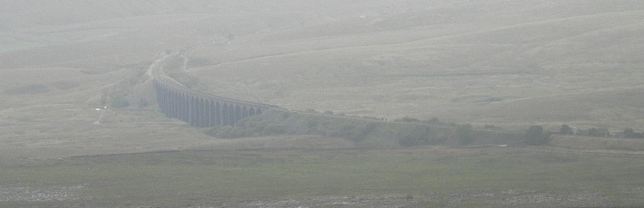
A misty view of the viaduct
The view is at times limited
Colt Park
As I dropped down off Top of South House Moor the mist cleared slightly to reveal the iconic Ribblehead Viaduct, an engineering marvel. My final destination Ribblehead Station lies at the southern end of it, as did my interim stop-off, the Station Inn. First though, there was the slight, but sweaty, reascent of Park Fell to contend with. Apparently there’s a trig point here. I could see nothing but grey and navigation was tricky here. The ridge walk diverts off in a different direction at the gate, ironically off the ridge, while my route carries on down towards Colt Park Farm. I slipped and slid a few times on the steep descent, but very soon I was striding through the last limestone outcrops and onto the B6479. There’s no pavement and the road dips, rises and twists the last few hundred yards before suddenly revealing and framing the iconic viaduct.
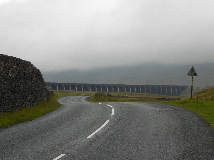
The Ribblehead Viaduct
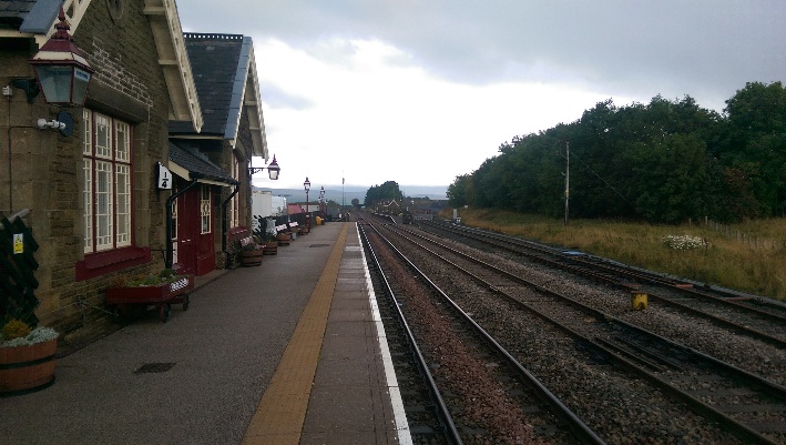
Ribblehead Station
I move into the pub for a quick drop of Station Inn Ale. It’s barely hit the back of my throat and I’m scooping up my gear and walking the last couple of hundred yards to the strangely disjointed Ribblehead Station. I think I’ve only seen one other station like this, with offset Up and Down platforms. My train appears a few minutes late, but I’m not concerned. I’m quite happy with the day, even with the rotten weather. Almost 10 miles in around 5 hours. Not the exploits of a racing snake, but at least for now I’m back in the race…
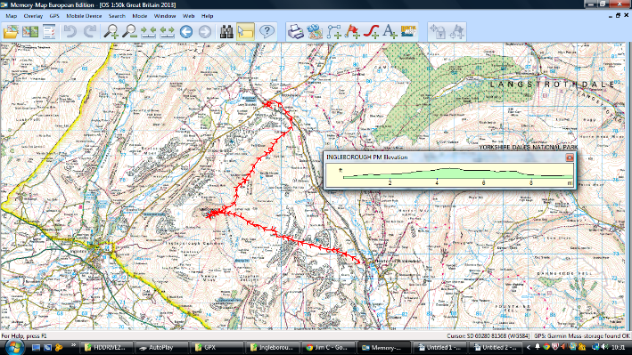
Map of my route
