

During recent rambles across the Pentland Hills I had noticed a dark lump of a hill off to the west, with a profile from here not unlike a mini Ingleborough, sweeping down to the flat plain below; and it had intrigued me from the first time I had saw it. The map revealed it to be East Cairn Hill. Far from the usual well trodden circuit, I decided that this would be my next port of call and began to plan my route.
The first obstacle was that it was well off the beaten path. Unlike the hills around Glencorse Reservoir it doesn’t have the great bus links to the city, so a linear walk across the Cauldstane Slap wasn’t too practical. There are excellent parking facilities at Flotterstone, Harlaw and Bavelaw, but only a small car park at Little Vantage, which hints at the fact this is a lesser trodden path. That was all by the by, as since moving to Edinburgh I’ve ditched the car anyway. And so it was I found myself traveling by train to Kirknewton, before cycling up to the car park at Little Vantage where I planned to leave my bike and carry out a circular walk taking in both East Cairn Hill and its neighbour, West Cairn Hill.
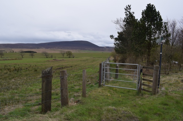
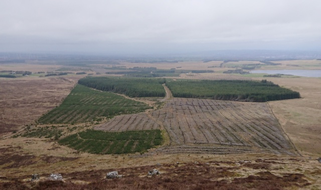
The start of the Thieves Road, East Cairn Hill visible.
The car park is small and poorly maintained, with the gravel surface scoured and rutted. I was glad I wasn’t in a car, and would want a 4×4 if I did. There’s also no facilities to secure cycles, so I found myself chaining my bike to the solitary metal rubbish bin, before secreting my pump and repair kit nearby. The Edinburgh area is renowned for cycle theft, as I was only too well aware, having had two bikes stolen from a “secure” storage area, as well as catching two guys in the act of stealing this bike. Having done that I was off, heading south along the footpath, along the old thieves road towards Cauldstane Slap and West Linton. Off to my left was the by now more familiar profile of the Pentlands I was used to, while ahead was a faint path across the boggy low ground, visible in parts only by the wooden boards which were laid across some of the wetter sections. If it was tricky making my way across here in these conditions it must have been hellish crossing here with many cattle, churning up the ground as they went. This looks like another route which is best attempted in very dry or very cold conditions, and best avoided after rainfall.
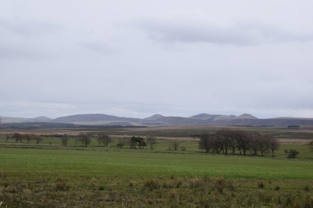
The more familiar Pentland profile.
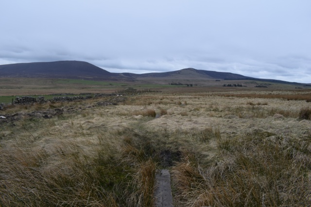
The route is faint, with boards over some of the worst sections
I don’t know if my legs were particularly leaden, but I felt that my progress was a times miniscule and it seemed like an eternity to make my way to the foot of East Cairn Hill proper. On the way I had passed over the Water of Leith, which flows through Harlaw Reservoir, one of a series of water sources created to feed the city of Edinburgh with drinking water. The dam at Harlaw was visible from here, as we’re a number of cast iron markers dating from the late 1850’s marked EWC, which I assume to be the Edinburgh Water Corporation. Their purpose is unclear, but they are possibly boundary markers. The way is well marked otherwise, though you need to take care near Harperig Farm as there is the chance you can make an error negotiating the gates.
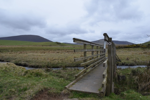
Bridge over the Water of Leith
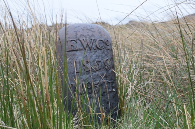
Boundary Marker?
Looking at the map I had decided that I was going to ascend the hill from the path at a point west of the cairn. What initially appeared to be a handily placed by stream bed turned out to be the path, and as ascended I began to feel the full force of the wind, which grew as I climbed. By the time I had reached the rocky summit and the stone shelter I was exposed to an icy wind which was cutting me to the bone, and I soon wished I was back at home on the couch, which is where my gloves were, having failed to put them in to my bag that morning.
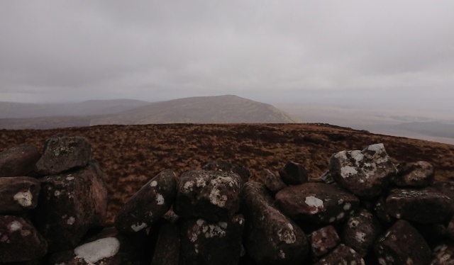
The view from East Cairn Hill towards West Cairn Hill
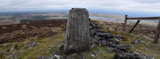
I huddled inside the shelter, assessing the map for the next section. I’d be dropping off this hill due south, to the Cauldstane Slap, before ascending West Cairn Hill. Steeling myself for the effects of the cold I stepped into the wind and headed down, as quickly as I was able. I was still chittering when I arrived at the Slap, an old Scots word for pass. This path is also known as the “Thieves Road”, no doubt from the bandits who would prey on travellers using the route. From here I headed south east alongside a drystane dyke, before dog legging north-east to the summit, marked by a trig point which has seen better days.
West Cairn Hill panorama
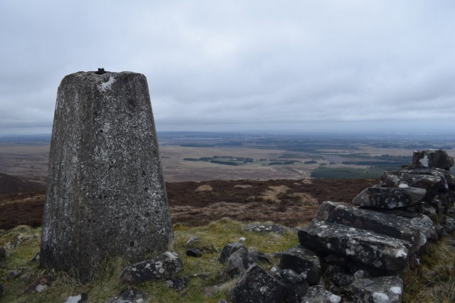
The summit trig point
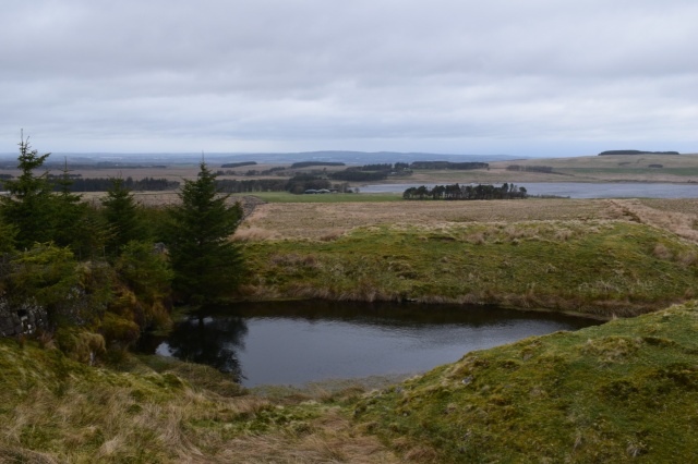
The wind was terrific here and I lingered only long enough to take some pictures before dropping down off the top to do a bit of map appreciation. The West Cairns Plantation had undergone some serious clearance work since publication of the map, although the outline was still recognisable. I pondered going through it, it’s access tracks now clearly visible, but instead decided to skirt around it towards Cairn House and the prominently marked tower.
Forestry clearance has left a distinctive outline
I was using my Harveys 1:40,000 pocket map and this has slightly more detail than the OS excerpt shown above. It shows a track running down from a small (and I mean small) quarry towards Cairn House, and this was my chosen route to get to the road. The track does run past some farm buildings and it’s only on getting to the tower that you can see signs which ask walkers to avoid the the farm itself by bypassing it, although quite where the path goes is not clear.
Small quarry, not marked on the OS 1,50,000 map
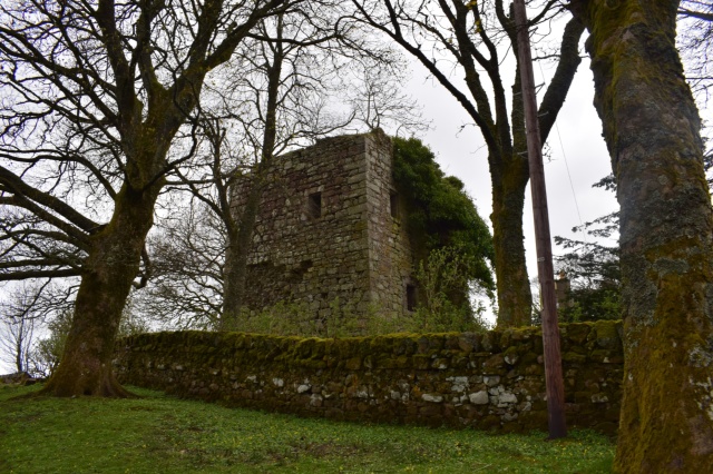
Cairns Castle
There is a path around Harperig Reservoir and I used this to get a quick photo of Cairns Castle. The castle dates back to the early 1400’s but as it is located entirely within the grounds of the house it is not accessible to the public. That being the case there was no point lingering, and so I hit the road for the last section of the walk,a 2km hike back to the bike along the A70, dodging traffic and observing with dismay the detritus discarded by passing motorists which has accumulated along the verges and in the fields. With the bike safely back in my hands I checked the train times to find that it would be over an hour before the next train. Luckily the wind was now at my back, which made the 13 mile cycle journey back into Edinburgh easier than the three miles uphill from Kirknewton earlier.
If you are looking to find a quieter, more remote section of the Pentlands Hills or explore, this little round might just fit the bill.
