I’ve never really been walking in England. If been in various army training areas, Stanford for example, home to Dad’s Army, or Otterburn. Plenty of experience in the outdoors, but all within the confines of training areas where you could go where you wanted. My Map Reading Instructors Course was carried out near Newbury in Berkshire, and it was there I was introduced to the strange concept of the English right of way. In Scotland if I see somewhere interesting, by and large I can walk to it across country. In England I had to stick to the red dotted line on the map, a very restrictive course, and one which has long deterred me from walking south of the border. The recent spell of bad weather has made mockery of the arrival of the so called summer, with ice laden winds bringing frost and snow on a daily basis. Avalanches also are a regular feature in the news, so I decided to give the higher tops a rest for a week or two, until things are more settled. Having a look around on Memory Map, I scrolled about here and there, looking for a reasonable linear walk. For some reason I was drawn south, firstly to Carlisle, then across the country, coming to rest at Haltwhistle, just south of Hadrian’s Wall. Some of the anti-independence brigade have hinted that should Scotland become independent there would be border checks and a need for passports to go to England. So where better to go then than the original border set up by the Roman Empire almost 2000 years ago? I checked the train times, packed my gear (minus passport) and readied for the off.
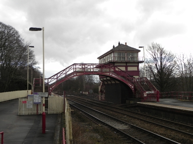
For this trip I would be accompanied by my daughter Olivia. Having previously studied the Romans in school this would be of great interest to her. If I recall correctly my one and only visit to the wall was some thirty years ago, on a school trip, and exactly where I can’t remember. This would be new territory for us both. The train journey to Carlisle passed quickly, leaving behind us a range of familiar hills. Tinto, Quothquan Law, Culter Fell, The Lowthers all disappeared behind us, giving way to the flatlands of the River Esk which herald arrival in England. We had time for a quick wander round the town before catching our connecting train. Olivia had noted that we had got a Scotrail train to Glasgow and a Virgin train to Carlisle. We were both surprised to find that our train which would carry us across the north of England was…another Scotrail train! A Saltire emblazoned 158 seems a strange choice for this service, until we found this train originated in Glasgow, taking the scenic route to Newcastle. A little over half an hour later we were on the platform at Haltwhistle, the old signalbox sitting high above the platforms. A proper railway station! Only later did I find out that the box itself closed in 1993, and signalling is actually done from a portacabin nearby! Likewise, the name Haltwhistle screams railway, but actually derives from the Saxon for the “meeting of the streams”.
Haltwhistle is one of two places which claims to be at the geographical centre of Great Britain, and this is marked in the village by various plaques and signposts indicating the ends of the country. It’s a very traditional looking village and we half expected to see Compo whizz past in a bathtub, followed by Foggy and Clegg.
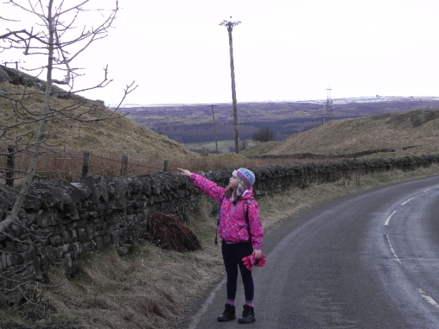
Leaving the village we took on the hardest climb of the day, a great way to get the heart going! The road climbs steeply, twisting and turning as it goes. On the way we discovered a geocache completely by accident, adding this to our two along the wall we had planned to visit. If you are taking kids along geocaches are a great way to encourage them, as it helps break up longer walks and gives them something to concentrate on. The other thing which helps on long walks is spotting birds and animals, and Olivia was able to spot some llamas as we passed Herding Hill campsite, I had wandered past them without even noticing them, surprising as they are a bit out of the ordinary.
We crossed the B6318 at the Milecastle Inn, just as a flurry of snow appeared briefly. We set the co-ordinates in the GPS for the first geocache and set off across the first red dotted line of the day. Within a few minutes we were at Milecastle 42, which is roughly halfway in the wall. There was a milecastle every Roman mile along the wall, built to house the troops stationed there and the foundations of this one remain in good condition. We recovered the geocache before walking downhill to Cawfields Quarry to recover our third cache, waiting for the bus load of German students to pass by before grabbing it.
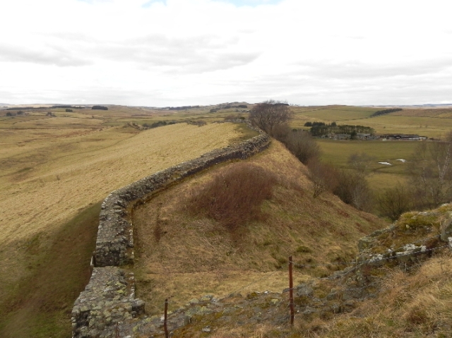
From here it was a fairly straightforward walk along the wall. When I say straightforward I do of course mean in the navigational sense. It does rise and fall a fair bit and is steep in parts. It’s also fairly exposed and the crest of the ridge was still coated with a fair bit of snow. All in all it’s enough to get the heart and lungs working, none more so than the climb up to the high point of the day, the trig point at 345m above Winshields.
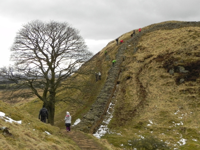
Beyond us lay the impressive looking Crag Lough and Steel Rigg. Nine times out of ten if you see a photo of Hadrians Wall it’s taken here. After a quick break we set off downhill, crossing the field to the road just south of the car park. We followed in the trail of a couple of rope laden climbers as the jangled along to the bottom of the crag. For us it was onwards and upwards, and a bit of a traffic jam as walkers and their dog tried to come down as we ascended. Being a school holiday it was fairly busy, despite the cold, and further on we met a group of very happy children as they scrambled up the wall near Milecastle 39. Who needs gadgets and batteries?
The walk along the top of the crag can be exposed and at one point a cleft near the path revealed a straight drop to the ice covered water below. Not somewhere to muck about, we carried on through some lovely pine woodlands before dropping down to the end of the crag near Hotbank. The path ahead looked interesting, but for us it was time to head for the train, so we took the right of way along the track to join the B6318. Now it was time to rely on those red dotted lines…
In Scotland you can plan a route, but whether there is a way across fences and walls in the hands of the gods. Here, where a right of way met a fence their was either a gate or a stile. Great for kids, as barbed wire fences can be tricky, whether you are big or small.

This is where the rights of way come in handy. Where they cross a fence or wall there’s a crossing point- brilliant for kids.
Following the right of way, firstly to High Shield, then downhill to Chesterholm, we could see the Roman fort of Vindolanda, busy with visitors. I had considered stopping in here but decided against it, deciding to visit on another occasion when we could give it a bit more time. Passing the old Roman milestone at Chesterholm I noticed the signpost indicated a route to Bardon Mill via Brackies Burn, and this looked far quicker than my intended route by road.
I decided to follow it, and although muddy in parts it was easy enough to follow (in the main), skirting past Roman villas and ornamental gardens before bringing us out at Cragside stables. We had missed the train, so had another spot of lunch before following a few more signposted rights of way to the A69. Below us lay Bardon Mill, with it’s collection of houses, pottery and signalbox. There’s little else (obvious to me anyway) so we settled for the warmth of the Bowes Hotel and the warmth of an open fire and the delights of the pool table, until it was time to head north once again. I’m sure I’ll be back again to do another part of the route along the wall, or perhaps just visit the fort at Vindolanda. Will I need my passport? Only time will tell!


We walked this route on Saturday, it was a great walk, challenging at times with the ice and snow however when on the wall the views were stunning…. thank you
It is a fantastic route. I’m hoping to come down and do it again this summer- when its warmer!